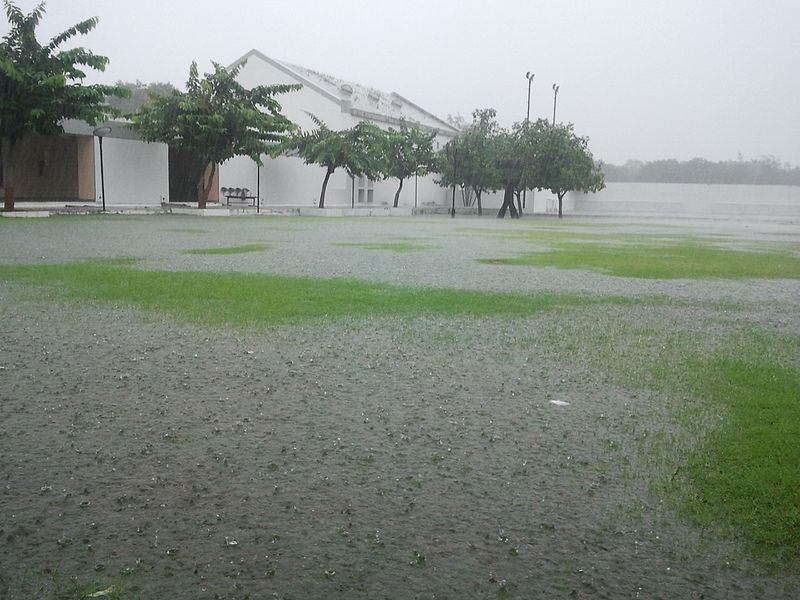
Much of the UK is bracing for another spell of wet and unsettled weather, with forecasters warning of flooding risks and travel disruption in the days ahead.
A slow-moving weather front is expected to linger over Wales and northern England, bringing persistent downpours. The rain will intensify into the weekend as a new low-pressure system moves in. In some upland areas, totals could reach 100–150mm, raising concerns about localised flooding and difficult driving conditions.
What’s happening across the regions?
Northern Ireland: The southeast could catch some of the heavier rain, but overall conditions won’t be as wet as earlier this month.
Scotland: A spell of wet and windy weather will ease into showers. It’s also turning colder, with the highest mountain tops possibly seeing a wintry mix by the weekend.
South-east England, Midlands, and East Anglia: A much warmer spell is on the way before the rain arrives. Some areas could hit 26°C on Friday before cooler, wetter air moves in over the weekend.
How much rain has already fallen?
Many parts of the UK have already seen nearly twice their usual September rainfall, driven by a stream of Atlantic low-pressure systems. Cardiff has had more rain this month than it saw during the entire summer. Northern Ireland, northwest England, and even southern counties have also been hit hard.
When will it dry up?
The good news: a shift to more settled weather is on the horizon. High pressure is forecast to return in the final week of September, bringing drier and sunnier conditions. Temperatures will dip a little below average, with the chance of chilly mornings, rural frosts, and early mist or fog.
So while the umbrellas are needed for now, brighter, calmer days aren’t too far away. Photo by Prabas007, Wikimedia commons.